Dismiss
Inovação
Uma plataforma criada para IA
Unificado, automatizado e pronto para transformar dados em inteligência.
Dismiss
16-18 juni, Las Vegas
Pure//Accelerate® 2026
Ontdek hoe u de ware waarde van uw gegevens kunt ontsluiten.
O que são dados geoespaciais?
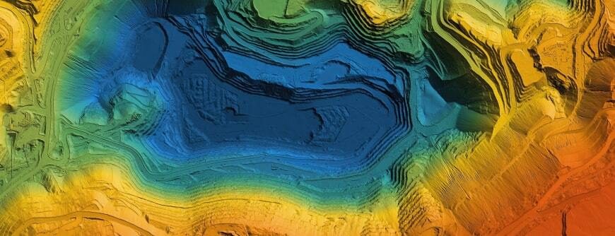
A definição mais simples é que dados geoespaciais são informações retratadas em um mapa. São dados relacionados a um local ou evento na superfície terrestre ou próximo a ela.
Os dados geoespaciais podem identificar locais e eventos que são estáticos e não mudam (como um prédio ou um terremoto anterior) ou locais e eventos dinâmicos e em mudança (como a disseminação de uma epidemia ou veículos em movimento). Os dados sobre o objeto ou evento normalmente incluem a localização, como coordenadas na Terra; as características do objeto ou evento, como seu nome; e dados “temporais”, indicando o tempo do evento ou o intervalo de tempo das imagens.
Os dados geoespaciais podem vir de muitas fontes, incluindo:
- Imagens de satélite
- Dados climáticos
- Dados do censo
Qual é a diferença entre dados geoespaciais e dados GIS?
Um sistema de informações geográficas (GIS, Geographic Information System) armazena informações geográficas e as integra a programas de software geográficos para que as informações espaciais possam ser analisadas e visualizadas. Os sistemas GIS usam e armazenam dados geoespaciais como parte de suas análises e visualizações.

Test drive do FlashBlade
Sem hardware, sem configuração, sem custo e sem problemas. Experimente gerenciar um Everpure FlashBlade, a solução mais avançada do setor que oferece armazenamento nativo de arquivos e objetos em expansão horizontal.
Aplicativos para dados geoespaciais
- Proteção ambiental: Os dados geoespaciais podem ajudar a detectar incêndios florestais enquanto eles estão acontecendo e também documentar o impacto deles.
- Agricultura: Os fazendeiros podem usar dados geoespaciais para acompanhar o progresso das culturas e avaliar a saúde das culturas.
- Logística: As empresas de transporte usam dados geoespaciais para rastrear mercadorias em envio, criar rotas e estimar os horários de chegada e partida.
- Meteorologia: Cientistas e pesquisadores podem acompanhar o progresso dos eventos climáticos e compartilhar alertas antes dos eventos, como furacões.
- Saúde: Os pesquisadores podem acompanhar a disseminação de surtos de doenças com dados geoespaciais.
- Varejo: Os dados geoespaciais ajudam os varejistas a entender os níveis de renda, a densidade populacional, a idade e a localização dos clientes em áreas geográficas próximas a locais físicos, para que as lojas possam decidir quais produtos e marcas vender.
Tipos de dados geoespaciais
Os dados geoespaciais se dividem em dois grupos: dados vetoriais e dados rasterizados.
Os dados do vetor são criados por pontos que indicam um local físico. Os pontos podem ser unidos por linhas ou polígonos, conforme descrito abaixo:
- Dados de ponto: Os dados de ponto representam pontos de dados específicos, como escolas e pontes. Ele também pode ser usado para representar nomes de lugares e locais de cidades.
- Dados de linha (também chamados de dados de arco): Os dados de linha são usados para representar recursos lineares, como ruas, trilhas ou rios que têm pontos de início e fim.
- Dados de polígonos: Os polígonos são usados para representar áreas como fronteiras de cidades, parques ou lagos.
Os dados de rasterização são criados com pixels ou células. Os dados armazenados em um formato raster podem vir de imagens de satélite, fotografias aéreas ou imagens digitais. Os dados raros podem ser usados para representar recursos como uso da terra ou cobertura arbórea, e até mesmo temperatura ou elevação.
Benefícios de usar dados geoespaciais
Ao visualizar dados geoespaciais, os tomadores de decisão podem ver mais facilmente como os dados comerciais vitais estão mudando ao longo do tempo e onde. Os aplicativos incluem:
Previsão de mudanças e eventos: Como os dados geoespaciais incluem informações temporais (baseadas no tempo), os pesquisadores podem usá-los para prever mudanças futuras ao longo do tempo. Os dados podem ajudar as empresas a decidir onde abrir novos locais, com base em mudanças na densidade demográfica, por exemplo. Em locais com secas ou inundações, os pesquisadores podem procurar sinais de que um evento catastrófico pode ocorrer no futuro e alertar os tomadores de decisão para tomarem medidas que possam salvar vidas ou culturas.
Entendendo a demografia: Tabelas mostrando a mudança na população, níveis educacionais e renda podem ser parte do caminho para contar uma história sobre cidadãos locais ou clientes em potencial. Mas ao combinar esses dados com dados de localização, os tomadores de decisão podem ver onde a mudança está acontecendo.
Produtos e soluções direcionados: A análise de dados geoespaciais pode esclarecer por que os produtos e as estratégias podem ter sucesso em uma região, mas falhar em outra.
Enfrente os desafios dos dados geoespaciais com a Pure Storage
Os dados geoespaciais são muito mais do que imagens ou pontos em um mapa. Ele conecta lugares ou eventos a pontos em um mapa para que possamos entender melhor o impacto da atividade humana em localizações geográficas, especialmente quando vemos dados geoespaciais ao longo do tempo. Mas armazená-lo pode representar desafios únicos.
Para ajudar a resolver seus desafios de dados geoespaciais, a Pure Storage® oferece várias soluções, incluindo:
- FlashBlade®: A plataforma líder mundial de arquivos e objetos unificados e rápidos (UFFO, Unified Fast File and Object). É ideal para análises, Machine Learning, Artificial Intelligence e processos de dados de borda semelhantes.
- FlashArray (Arfray -: Combina o alto desempenho do armazenamento totalmente flash comintegração VMware para criação de uma solução de nuvem híbrida.VMware Ele é compatível com uma infraestrutura multimodo 5G que combina máquinas virtuais e contêineres.
A alta densidade, o baixo consumo de energia e o gerenciamento remoto fácil do FlashBlade e do FlashArray os tornam ideais para implantações em locais de borda.
Além disso,a Portworx® da Pure Storage oferece uma camada de armazenamento para executar cargas de trabalho nativas de nuvem na borda. Ela oferece uma solução completa para workloads em contêiner, incluindo backup e Disaster Recovery. A Portworx se integra ao FlashBlade e ao FlashArray para garantir alto desempenho e confiabilidade.

Test drive do FlashArray
Veja como an Everpure simplifica consideravelmente blocos e arquivos em um ambiente de autoatendimento.
Também recomendamos…
Confira os principais recursos e eventos
FEIRA DE NEGÓCIOS
Pure//Accelerate® 2.026
June 16-18, 2026 | Resorts World Las Vegas
Prepare-se para o evento mais valioso do ano.

DEMONSTRAÇÕES SOBRE O PURE360
Explore, conheça e teste a Everpure.
Acesse vídeos e demonstrações sob demanda para ver do que a Everpure é capaz.
VÍDEO
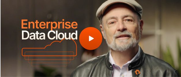
Assista: O valor de um Enterprise Data Cloud.
Charlie Giancarlo sobre o por que de gerenciar dados — e não o armazenamento — é o futuro. Descubra como uma abordagem unificada transforma as operações de TI corporativas.

RECURSO
O armazenamento legado não pode potencializar o futuro.
Cargas de trabalho avançadas exigem velocidade, segurança e escala compatíveis com a IA. Sua pilha está pronta?
Personalize for Me