Dismiss
Innovations
Everpure Simplifies Enterprise AI with Evergreen//One for AI and Data Stream Beta
Accelerate the transition from pilot to production with benchmark-proven performance, automated data pipelines, and a flexible consumption model.
Dismiss
June 16-18, Las Vegas
Pure Accelerate 2026
Discover how to unlock the true value of your data.
Dismiss
Innovation
A platform built for AI
Unified, automated, and ready to turn data into intelligence.
What Is Geospatial Data?
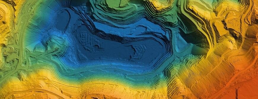
The simplest definition is that geospatial data is information that’s portrayed on a map. It’s data that relates to a place or event on or near the Earth’s surface.
Geospatial data can identify locations and events that are static and don’t change (such as a building or a previous earthquake) or locations and events that are dynamic and changing (such as the spread of an epidemic or moving vehicles). The data about the object or event usually includes the location, such as coordinates on Earth; the characteristics of the object or event, such as its name; and “temporal” data, indicating the time of the event or the time span of images.
Geospatial data can come from many sources, including:
- Satellite imagery
- Weather data
- Census data
What’s the difference between geospatial data and GIS data?
A geographic information system (GIS) stores geographic information and integrates it with geographic software programs so that spatial information can be analysed and visualized. GIS systems use and store geospatial data as part of their analyses and visualizations.

Test Drive FlashBlade
No hardware, no setup, no cost—no problem. Experience managing an Everpure FlashBlade, the industry's most advanced solution delivering native scale-out file and object storage.
Applications for geospatial data
- Environmental protection: Geospatial data can help detect forest fires while they’re happening and also document the impact of them.
- Agriculture: Farmers can use geospatial data to track progress of crops and assess crop health.
- Logistics: Transportation companies use geospatial data to track goods in shipment, create routes, and estimate arrival and departure times.
- Meteorology: Scientists and researchers can track the progress of weather events and share alerts in advance of events, such as hurricanes.
- Healthcare: Researchers can track the spread of disease outbreaks with geospatial data.
- Retail: Geospatial data helps retailers understand the income levels, population density, age, and location of customers in geographic areas near brick-and-mortar locations, so stores can decide which products and brands to sell.
Types of geospatial data
Geospatial data falls into two groups: vector data and raster data.
Vector data is created by points that indicate a physical location. The points can be joined by lines or polygons, as described below:
- Point data: Point data represents specific data points, such as schools and bridges. It can also be used to represent place names and city locations.
- Line data (also called arc data): Line data is used to represent linear features such as streets, trails, or rivers that have start and end points.
- Polygon data: Polygons are used to represent areas such as city boundaries, parks, or lakes.
Raster data is created with pixels or cells. The data stored in a raster format can come from satellite imagery, aerial photographs, or digital images. Raster data can be used to represent features like land use or tree cover, and even temperature or elevation.
Benefits of using geospatial data
By visualizing geospatial data, decision-makers can more easily see how vital business data is changing over time and where. Applications include:
Predicting change and events: Because geospatial data includes temporal (time-based) information, researchers can use it to predict future change over time. The data can help businesses decide where to open new locations, based on changes in population density, for example. In places experiencing droughts or flooding, researchers can look for signs that a catastrophic event may occur in the future and alert decision-makers to take steps that could save lives or crops.
Understanding demographics: Tables showing change in population, education levels, and income can go part of the way in telling a story about local citizens or prospective customers. But by combining this data with location data, decision-makers can see where change is happening.
Targeting products and solutions: Analysis of geospatial data can shed light on why products and strategies may succeed in one region but fail in another region.
Address Challenges of Geospatial Data with Everpure
Geospatial data is much more than images or points on a map. It connects places or events to points on a map, so we can better understand the impact of human activity on geographic locations, especially when we view geospatial data over time. But storing it can pose unique challenges.
To help solve your geospatial data challenges, Everpure offers several solutions, including:
- FlashBlade®: The world’s leading unified fast file and object (UFFO) platform. It’s ideally suited for analytics, machine learning, artificial intelligence, and similar edge data processes.
- FlashArray™: Combines the high performance of all-flash storage with VMware integration to create a hybrid-cloud solution. It supports a 5G multimode infrastructure that combines virtual machines and containers.
The high density, low power consumption, and easy remote management of both FlashBlade and FlashArray make them ideal for deployments at edge locations.
In addition, Portworx® by Everpure provides a storage layer for running cloud-native workloads at the edge. It delivers a complete solution for containerized workloads, including backup and disaster recovery. Portworx integrates with both FlashBlade and FlashArray for high performance and reliability.

Test Drive FlashArray
Experience how Everpure dramatically simplifies block and file in a self service environment.
We Also Recommend...
Browse key resources and events
TRADESHOW
Pure Accelerate 2026
June 16-18, 2026 | Resorts World Las Vegas
Get ready for the most valuable event you’ll attend this year.

PURE360 DEMOS
Explore, learn, and experience Everpure.
Access on-demand videos and demos to see what Everpure can do.

VIDEO
Watch: The value of an Enterprise Data Cloud
Charlie Giancarlo on why managing data—not storage—is the future. Discover how a unified approach transforms enterprise IT operations.

BLOG
What’s in a Net Promoter Score?
For nine consecutive years, Everpure has maintained a Net Promoter Score of over 80. Find out how we did it and what it means for our customers.
Personalize for Me